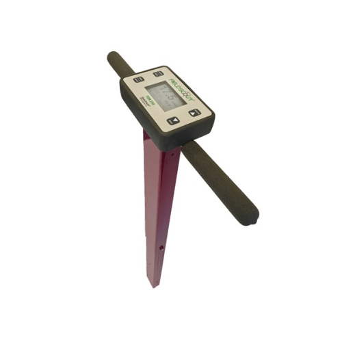
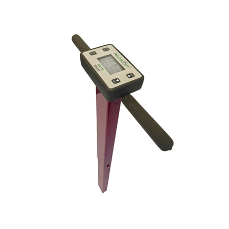
Offering the proven time-domain measurement technology you have come to recognize for more than 30 years, the TDR 350 accurately measures soil moisture across the full range of soil conditions. Improved ergonomic design provides quick and easy measurements. Validate your cultural practices with hands free data collection integrated with Bluetooth and GPS.
Features:
- Increased accuracy of soil moisture (Volumetric Water Content)
- Measures EC (Electrical Conductivity)
- Measures Turf Surface Temperature
- Integrated Bluetooth and GPS
- Data logger records approximately 50,000 measurements
- Industry exclusive backlit display
- Improved shaft-mounted probe with telescoping tubular frame
- Data collected with USB flash drive
- No PC interface needed
- Powered by AA lithium batteries
- Compatible with SpecConnect and FieldScout App
- TDR Rods are required. Select the needed size under the Related Accessories tab
Specifications
- Measurement Principle: Time - domain measurement methods
- Measurement Units: Percent Volumetric Water Content (VWC)
- Resolution: 0.1% VWC
- Accuracy: +/- 3.0% VWC with Electrical Conductivity (EC) < 2 mS/cm
- Range: 0% to saturation (Saturation up to about 50% volumetric water depending on soil type)
- Battery/Life: 4 AA batteries
- Data Logger: 50,000 measurements
- EC Range: 0 to 5 mS/cm, Resolution: 0.01 mS/cm, Accuracy: +/- 0.1 mS/cm
- Temperature Range: -30 C to 60 C, Resolution: 0.1, Accuracy: +/- 1 C
App data:
Use the FieldScout Mobile app to instantly collect and display data. Collects data from the new FieldScout TDR 350 Soil Moisture Meter using Bluetooth
Smart connection.
Visualize real time readings on a Bluetooth Smart Ready smartphone or tablet in the field
- Color coded to represent a scale of moisture, EC, surface temperature or turf firmness
- E-mail relevant information to communicate results with others
- Free download from Apple App Store or Android Google Play
Promode additional features (requires a SpecConnect subscription, sold separately):
- Google Maps dynamic satellite image shows readings data overlaid on your property
- Guided Mode allows for taking grid readings without interacting with the phone
- Freeform Mode plots a point for each reading, and stores its data independently
- Automatic wireless upload to SpecConnect for further analysis from your personal web portal
- Eliminates the need for a computer, cable and GPS accessory
- SpecConnect provides complete data overview at once, overlaid on a satellite map
- Color Gradient Mapping of data points within custom selected areas or groupings
- Export your data from SpecConnect into an Excel document for deeper analysis